

Invitation letter and Agenda
Dear Sir/Madam,
Moving Geodata and services to the Cloud: exchanges about use cases and challenges
This is an invitation to the “Moving Geodata and services to the Cloud: exchanges about use cases and challenges” workshop of the E.C. project INspired GEOdata CLOUD Services (InGeoCloudS).
The workshop will be held in Paris, France on 9-10th of May 2012.
Attendance is free. Click here for the Workshop Agenda.
The INspired GEOdata CLOUD Services project is co-funded by the European Commission under “The Information and Communication Technologies Policy Support Programme” (CIP-297300), which aims at demonstrating the feasibility of employing a cloud-based infrastructure coupled with the necessary services to provide seamless access to geospatial public sector information, especially targeting the geological, geophysical and other geoscientific information.
The project involves 8 partners from 5 different countries in Europe.
- AKKA Informatique et Systèmes (AKKA, France) – Project Coordination and Technical Management
- BUREAU DE RECHERCHES GEOLOGIQUES ET MINIERES (BRGM, France)
- FOUNDATION FOR RESEARCH AND TECHNOLOGY HELLAS (FORTH, Greece)
- GEOLOSKI ZAVOD SLOVENIJE (GeoZS, Slovenia)
- The Geological Survey of Denmark and Greenland (GEUS, Denmark)
- INSTITUTO GEOLOGIKON KAI METALLEYTIKON EREYNON (IGME, Greece)
- CONSIGLIO NAZIONALE DELLE RICERCHE (CNR, Italy)
- OASP - EARTHQUAKE PLANNING AND PROTECTION ORGANIZATION (EPPO, Greece)
A few words about the project
In the field of environmental information, the sharing of spatial data is crucial to all public actors, whether public administration, associations, research institutes, environmental groups or industrial and service companies. Environmental data are essential sources of information for users in their daily life (e.g. real estate risk, drinking water, food, air and soil contamination, ground motion). The European Directive INSPIRE intends to provide a new spatial data infrastructure in Europe in the environmental field. Access and sharing spatial datasets are major challenges for each producer (mainly public authorities) since both an extensive and advanced technical infrastructure and the ability to overcome organizational and technical constraints are required.
The objective of this project is to demonstrate that a cloud infrastructure can be used by public organizations to provide competitive procedural and technical solutions for creating, sharing, disseminating and aggregating spatially referenced environmental data, thus facilitating an efficient production and maintenance of innovative services around them. Groundwater quality and geohazards management are taken as illustrative domain fields.
In the context of the project, architecture and tools implemented will focus on two broader issues related to geoscience data: (1) Management of water resources, especially groundwater, which is a major issue around the use of the resource (water requirements for Water drinking supply, irrigation for agriculture, industry needs), crisis management in case of drought or flooding. A water quality management and achievement of the good status of groundwater in relation with the Water Framework Directive (WFD) completes the challenge. (2) Management of natural hazards, particularly those related to (a) the soil and subsoil, (b) earthquakes and (c) landslides that are associated to disaster management systems.
On top of the basic cloud services the project plans to demonstrate the ability to build more intelligent services by using and combining data seamlessly integrated through the cloud. Based on the gained experience, the project will provide guidelines in order to support the partners and other stakeholders of public information in their efforts to move more of their services and data to the cloud.
The Workshop
The aim of the “Moving Geodata and services to the Cloud: exchanges about use cases and challenges” workshop is to give a brief review on cloud computing, to discuss the advantages and disadvantages of moving data and services to the cloud, and provide an insight into how geodata services can take advantage of the cloud technology (in terms of data integration and standardization, system availability, performance and scalability, cost savings and enhanced manageability). Specific administrative issues regarding moving data and services to the cloud will also be addressed.
As a demonstration of potential geodata applications that can benefit from moving to a cloud infrastructure, a number of use cases along with the underlying necessary data will be presented. Through interaction with the interested parties, these use cases will be further elaborated and tuned in order to better meet the needs of the Geo-community. Ideas and suggestions about other relevant use cases can also be discussed and help refine the candidate services that will be uploaded to the cloud.
The data/services will cover the subjects of (a) groundwater and (b) natural hazards, monitoring and/or management. Briefly, the use cases that will be presented in the workshop by the five consortium data providers are the following:
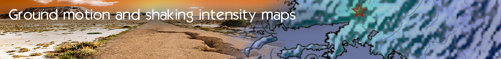
- EPPO – Greece. Web service that publishes Site Information on Accelerometer Stations of the Greater European Region. It includes geoinformation that describes each site like Morphological, Geological, Geotechnical, and Geophysical data. The service will be extended to include shake-maps (maps showing ground movement and shaking intensity following major earthquakes). Through this service it will be possible to propose the land usage (urban planning, type of structures), increase preparedness in case of a strong earthquake event, and provide the first information in a disaster management system
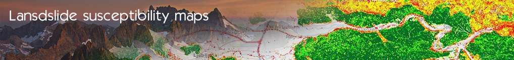
- GeoZS - Slovenia. Web based GIS application for estimation of geohazard induced by mass movement process. It enables simple, but effective access to the landslide susceptibility map. The service will be extended to include prediction modeling of geohazards (demanding versatile calculation infrastructure), usable for risk assessment and vulnerability analyses.
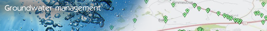
- GEUS - Denmark. Web service that identifies areas where high concentrations of pesticides are found in groundwater. To facilitate pan European searches, the service will be extended to consolidate the resulting data from several countries' web services into a single result which is harmonized, despite differences in database structure, exchange format, measurement units or other country specific conditions.
- GEUS - Denmark. Web service that extracts cross border groundwater levels. To facilitate cross border modeling, the service will be extended to consolidate the resulting data from several countries' web services into a single result which is harmonized, despite differences in database structure, exchange format, reference level or other country specific conditions.
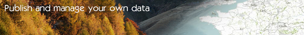
- BRGM - France. Web service to publish geospatial data for environmental public information in relation with description Aarhus and Inspire requirements. The service will take advantage of the scalability of the cloud infrastructure to adjust service load. The service will be extended to allow quick and smooth publishing of data with respect to regulation requirements (INSPIRE). Also, it will allow the sharing and re-use of data published by each partner to create new services without technical issues.
- BRGM - France. Web service for the aggregation of geodata information about geohazards provided by local authorities allowing creating national or European data in the risk and hazard fields. The service will be extended to provide a generalization of the process, allowing for automatic checking and aggregating of geodata web services for providing information and updates to producers, public and private users of the data.
- IGME - Greece. Ground Water resources management in granular aquifers: The Greek use cases. Web based GIS applications for the water balance estimation, for the creation of hydro chemical and salinization maps and for the regional contamination. The services could be extended with data from several countries.
Best regards
Benoit BAURENS
InGeoCloudS Project Coordinator
- Log in to post comments
Last updates
Project's Calendar

Only for consortium members
Contact: you can contact the Consortium using the generic address: contact [@] ingeoclouds.eu. Thanks!
This project is partially funded by the European Commission CIP Program. This website reflects the views of the authors only, and the Commission cannot be held responsible for any use which may be made of the information contained therein.

InGeoCloudS Users Documentation and other documents of this Web
site by the InGeoCloudS consortium members
are licensed under a Creative Commons Attribution-NonCommercial-ShareAlike 3.0 Unported License.
Based on a work at http://www.ingeoclouds.eu/.
Ad banners and pictures are (c) AKKA Technologies