


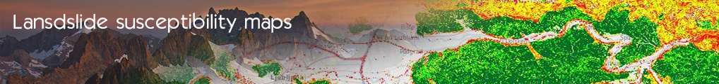

Landslides Susceptibility Maps Due to Rainfall Forecast
Geohazard use case was designed and built in a cloud infrastructure (InGeoCloudS) by Geological survey of Slovenia for Administration of the Republic of Slovenia for Civil Protection and Disaster Relief and public agencies in the spatial-environmental field. It provides an efficient, flexible, scalable and in all ways innovative infrastructure for Geodata services. Geohazard use case is a part of innovative inspire compliant cloud based infrastructure -> InGeoCloudS project.
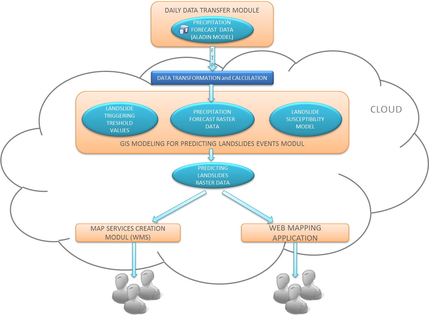
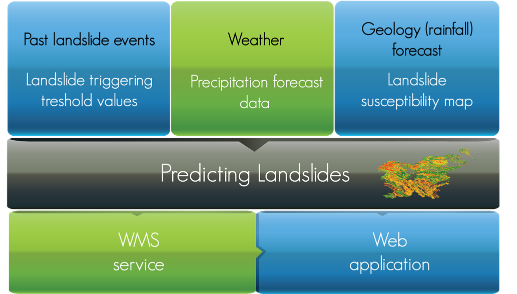
Geohazard use case is predicting the areas where the probability of triggering landslides is increased due to higher precipitation levels. The endangered zones are predicted using the combination of a landslide susceptibility model, precipitation forecasts and landslide triggering threshold values.
- Log in to post comments
Last updates
Project's Calendar

Only for consortium members
Contact: you can contact the Consortium using the generic address: contact [@] ingeoclouds.eu. Thanks!
This project is partially funded by the European Commission CIP Program. This website reflects the views of the authors only, and the Commission cannot be held responsible for any use which may be made of the information contained therein.

InGeoCloudS Users Documentation and other documents of this Web
site by the InGeoCloudS consortium members
are licensed under a Creative Commons Attribution-NonCommercial-ShareAlike 3.0 Unported License.
Based on a work at http://www.ingeoclouds.eu/.
Ad banners and pictures are (c) AKKA Technologies