


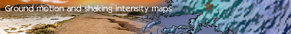

Shakemaps for Greek Region
State and regional organizations have a need for real-time maps of ground motion and shaking intensity following significant earthquakes. This information is required for post-earthquake response and recovery as well as for preparedness exercises and disaster planning.
In the “Shake-maps” use case, implemented by EPPO, strong motion recordings from the EPPO's Strong Motion Network is processed and a collection of ground motion and shaking intensity maps are produced, in various formats, after significant earthquake events. These include images for public and media use as well as geo-referenced maps and grids for scientific and operational use. The shake-map calculation is based on the widely used USGS ShakeMap® software, which is provided under the GNU General Public License. The earthquake information is provided by the Seismological Station of the University of Thessaloniki.
The InGeoCloudS platform provides the necessary scalability and maximized availability required by this time-critical application whose performance requirements are expected to scale exponentially in cases of significant earthquake events.
In the final version of the service, the shake-maps are displayed as layers over the earth map. The end user is able to access and download desired shake-map data by browsing a chronological archive sorted by earthquake. A search/filtering functionality will also be provided in INSPIRE compliant metadata. Moreover, by exploiting some of the advanced features of the InGeoCloudS platform regarding data publication, shake-map data will be available through: WMS and WFS OGC services, according to INSPIRE requirementsunique URIs, following the guidelines of the Linked Data Initiative
The “Shake-maps” use case provides the end user with personalized notification services, tuned according to the user's needs (geographical area, earthquake magnitude, maximum acceleration and velocity values etc.).
Finally, using the InGeoCloudS ShakeMap installation, eligible end users are able to calculate shake-maps from data they provide (either real or scenario data) using a provided OGC WPS service.
- Log in to post comments
Last updates
Project's Calendar

Only for consortium members
Contact: you can contact the Consortium using the generic address: contact [@] ingeoclouds.eu. Thanks!
This project is partially funded by the European Commission CIP Program. This website reflects the views of the authors only, and the Commission cannot be held responsible for any use which may be made of the information contained therein.

InGeoCloudS Users Documentation and other documents of this Web
site by the InGeoCloudS consortium members
are licensed under a Creative Commons Attribution-NonCommercial-ShareAlike 3.0 Unported License.
Based on a work at http://www.ingeoclouds.eu/.
Ad banners and pictures are (c) AKKA Technologies